INTERNATIONAL ROSETTA SKYRACE
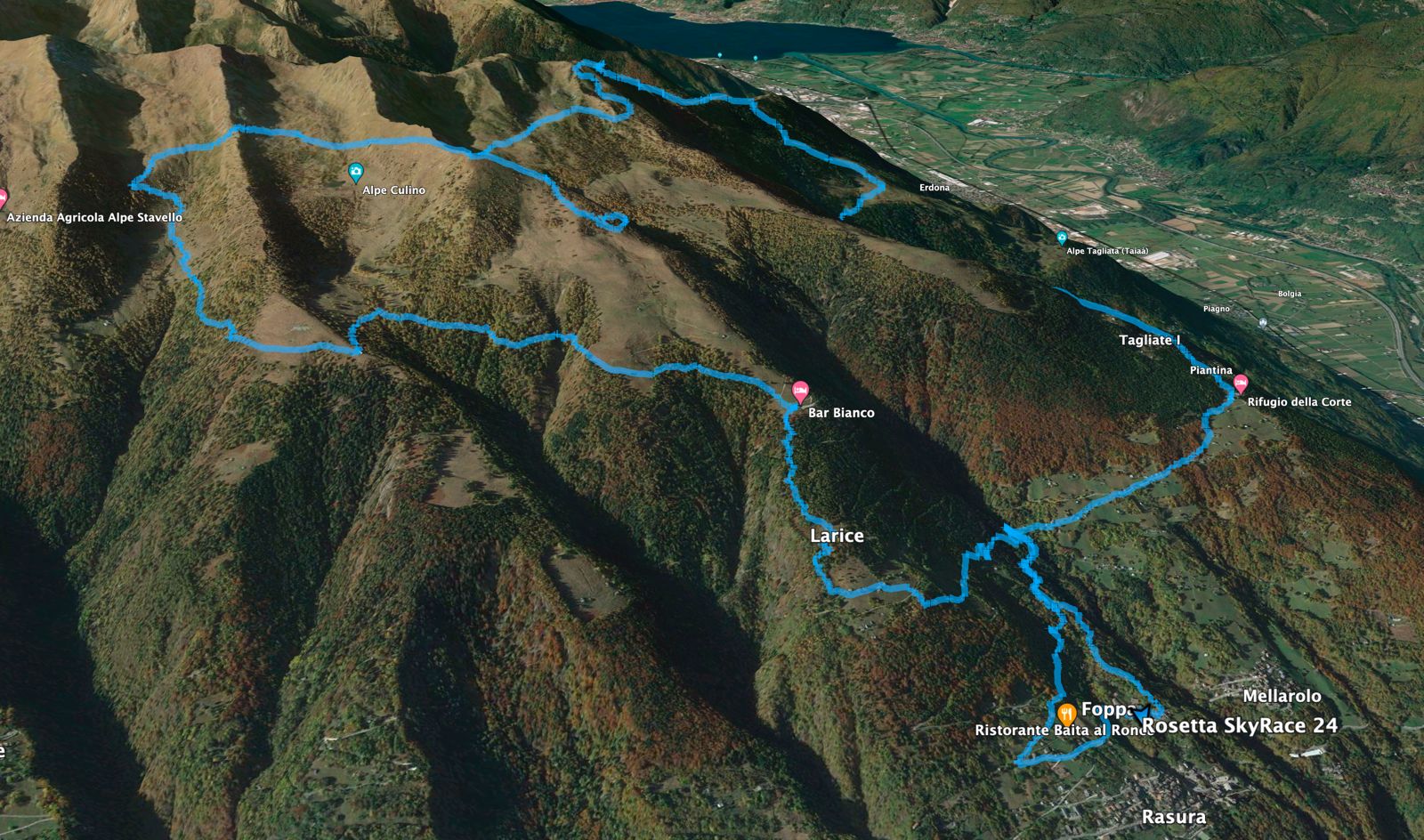
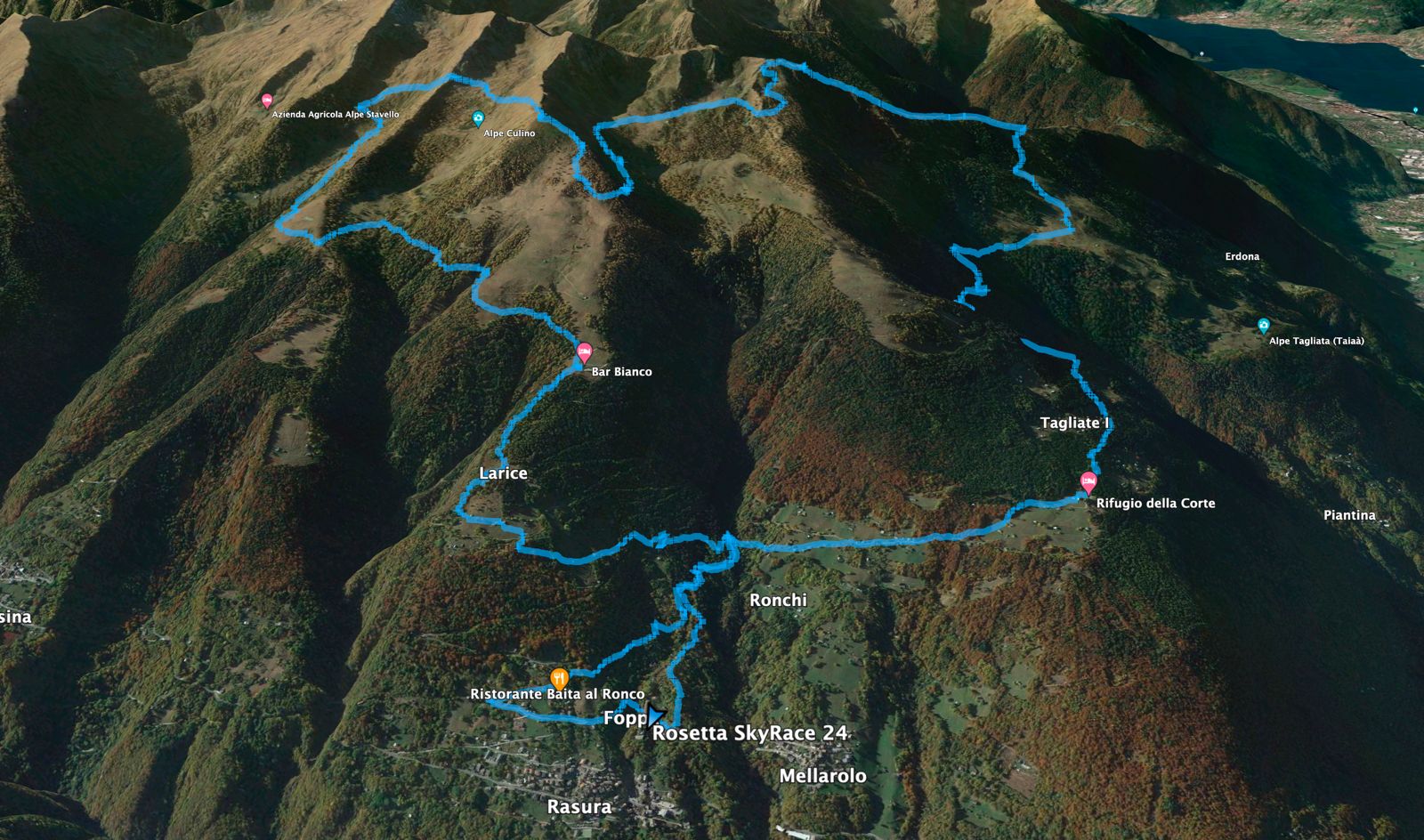
The Route
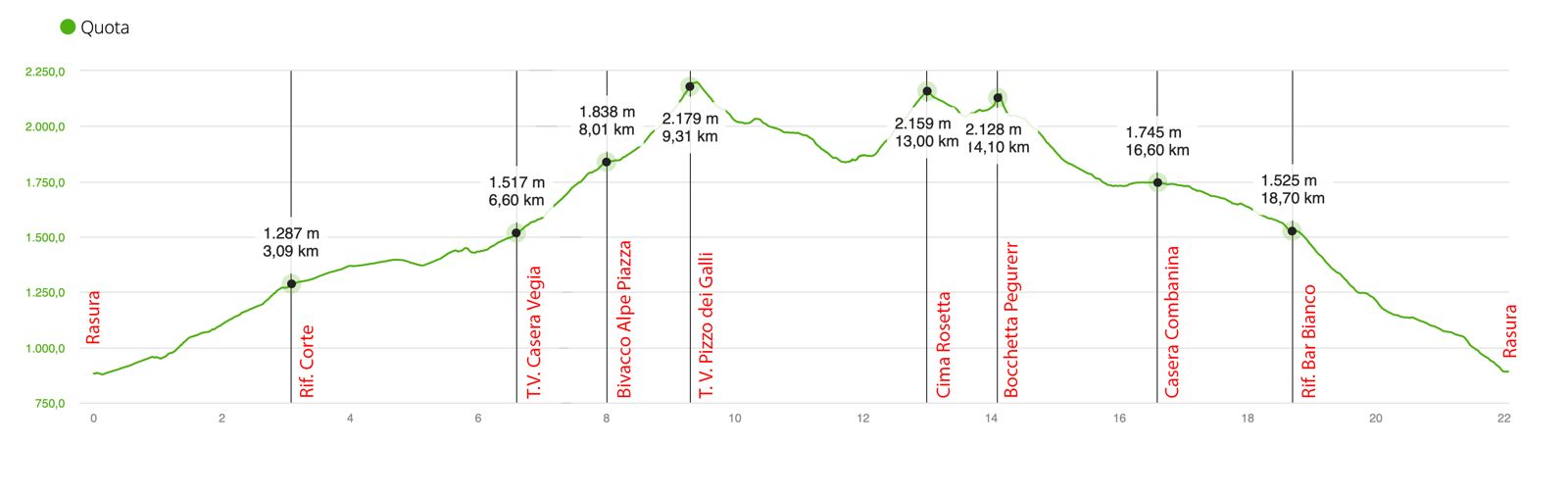
In Rasura, after the start, the runners in the race will climb to the maggenghi dei Ronchi and della Corte, where the refuge of the same name will be the site of the first refreshment. Leaving the refuge still climb for a short stretch to the Tagliate di Mezzo and then, with a sharp right turn, taking the driveway and the next path, reach the beautiful pasture of Alpe Tagliata, where there will be the first flying finish line at Km 6.4 at the Casera vecchia.
After this rather flat section, you begin to climb toward the historic Alpe Piazza pasture, where Bitto cheese is produced.
After passing the casera of Alpe Piazza and reaching the ridge, continue to the bivouac of Piazza, located in a beautiful plateau with a small lake, and then climb towards Pizzo dei Galli.
This section offers, without a shadow of a doubt, an unparalleled panoramic view of the Bassa Valtellina, where the imposing silhouette of Mount Legnone acts as an authentic bulwark. On Pizzo dei Galli, altitude mt. 2217, is located the Grand Prize of the mountain.
Continue to the Olano alpine pasture, after a short descent to the upper part of the beautiful Olano alpine pasture, stretches on a fun up and downhill that comes out at Alpe Culino. Another historic alpine pasture where Bitto cheese is produced, from where we climb up to Cima Rosetta at mt. 2142.
Now begins a descent as spectacular as it is, just over a kilometer to the Baita della Cima, where the trail again begins to climb a short stretch of scree until it reaches Bocchetta Pegurer, elevation mt 2200. The descent from Bocchetta Pegurer is the most technical section of the course, once past this section the competitors will begin the runnable descent to the casere of Combana, Combanina and the Bar Bianco farmhouse.
The last stretch is a breathless descent, which brings the competitors back to the maggengo of Larice and then ends the effort at the Polifunzionale di Rasura where the finish line is located.
GPS track to download (in .gpx format):